Showing posts with label Foss Barrier. Show all posts

Friday, 25 September 2009

Follow The Foss - 1 - Blue Bridge to Castle Mills Bridge

Over the coming days I plan to meander along York's second river the River Foss.Journeying on foot I plan to take a photograph at approximately every 100 paces to show the changing scenery and character of the river. In some places where no path is available it will be necessary to make a small diversion around obstacles and rejoin the river as the earliest opportunity.  Starting from the confluence of the Foss and the larger Ouse the route will proceed upstream through the city centre and out of the city towards Huntington. In general the photographs will be looking upstream along the river in the direction of travel except when following a diversion around an obstacle or when an interesting downstream opportunity presents itself..


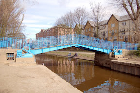
Blue Bridge a hand cranked lifting bridge.


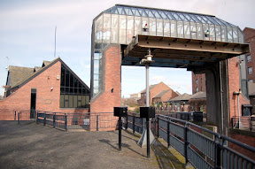
Foss barrier flood prevention scheme


Approaching Foss Basin and Castle Mills lock with Castle Museum in background


Foss basin with Castle Museum in background, the locks can be seen to the right of the picture.


 Castle Mills lock


Castle Mills bridge is the first diversion away from the river, turning left at the top of the steps beside the lock follow the footpath to the end of the railings and then cross the road at the earliest opportunity, traffic permitting. Continue away from the river aournd the Law Courts and Castle Museum building.


View Follow The Foss in a larger map

To be continued

Tuesday, 18 March 2008

Foss Barrier and Pumping Station

The barrier is part of the flood defences created after the severe floods of 1982. The River Ouse is fed by the Rivers Ure, Swale and Nidd draining the Yorkshire Dales and often used to cause a back flow along the low lying River Foss flooding areas of York like Foss Islands and Huntington Road bordering the river. To prevent the back flow along the Foss the barrier was constructed and is lowered when the level of water at the barrier reaches 7.8 metres. The weight of the barrier is sixteen and a half tonnes. To prevent the water in the River Foss Backing up on itself the water is pumped from the Foss into the River Ouse. During the severe floods of Autumn 2000 the barrier was in place for 18 days and the pumps were used continuously for ten days at a power consumption cost of £20,000.

Monday, 17 March 2008

Blue Bridge

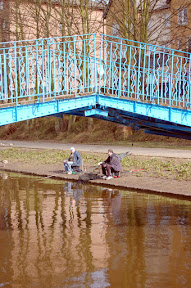
Built in 1895, Blue Bridge replaced the previous bridge built in 1738. The bridge stands at the mouth of the River Foss where it joins the River Ouse. Note two fishermen sitting at the side of the Foss. The bridge is located just beyond the Foss barrier and pumping station.

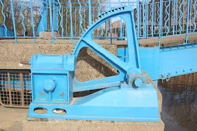
There is gear for lifting the bridge but I don't know if it has been used in the recent past. The paint on the teeth looks far too pristine to me.